
Art+Design
Experimental Work 3
This project is an exhibition in preparation on the idea of migrations…
My own family migrated here to the U.S. over a century ago. It was in another time, when distances were traversed on foot and by boat, and movement from place to place was considered without GPS coordinates. But modernity has entered migration. Now we have devices to precisely measure distance, time, and location. But migration for many still means long treks by foot, far from any modern conveniences…
I began to think about Google Maps™ and modern migrations. What would Google Maps™ say to those who walk, sometimes long distances? What if I were migrating, and asked this inhuman software system to tell me how I should go? The project then took visual form when I was pondering the idea of walking to a place just outside of Philadelphia, a place to which I would normally drive or take the train. I rarely use Google Maps™, but I was curious as to whether the application actually would show me walking directions for a significant distance. Google Maps™ told me that the walk that I was considering would be 22.8 kilometers, and would take 4 hours and 52 minutes.
Then I began experimenting with longer and longer distances, planning epic "digital walks" that I would never take. What I found is that the application, in fact, will give walking directions even for vast migratory distances: as long as Vladivostok, Russia, to Cape Town, South Africa — a distance of 21,191 kilometers, a walk which would take (says Google Maps™) some 4,177 hours. My initial "digital walk" began from a locale in my hometown of Philadelphia (I chose train and bus stations, city halls, and churches as simple starting-out points and destinations), but then I began exploring further. This led me from a simple "digital walk" to a series of "digital migrations": in each case, Google Maps™ told me that these epic migrations were indeed possible...
Some sample pieces from this planned exhibition are shown below…
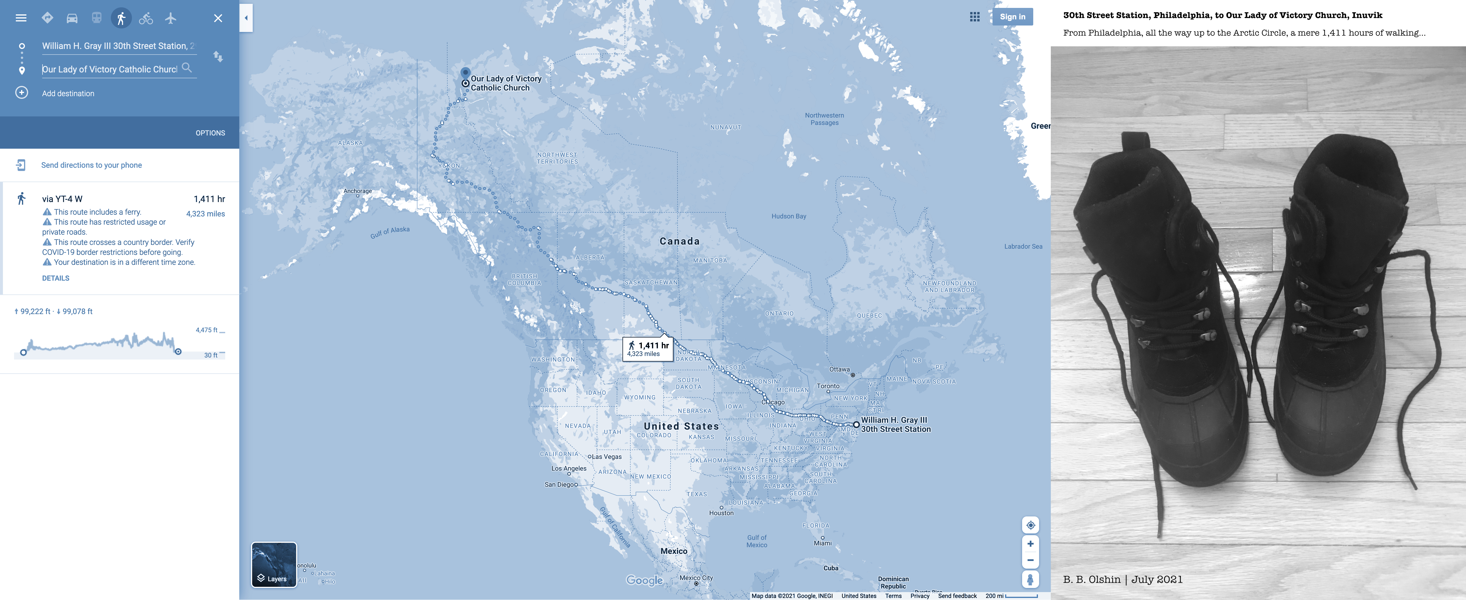
Digital Migration No.1-30th Street PHL to Our Lady of Victory Church Inuvik YEV
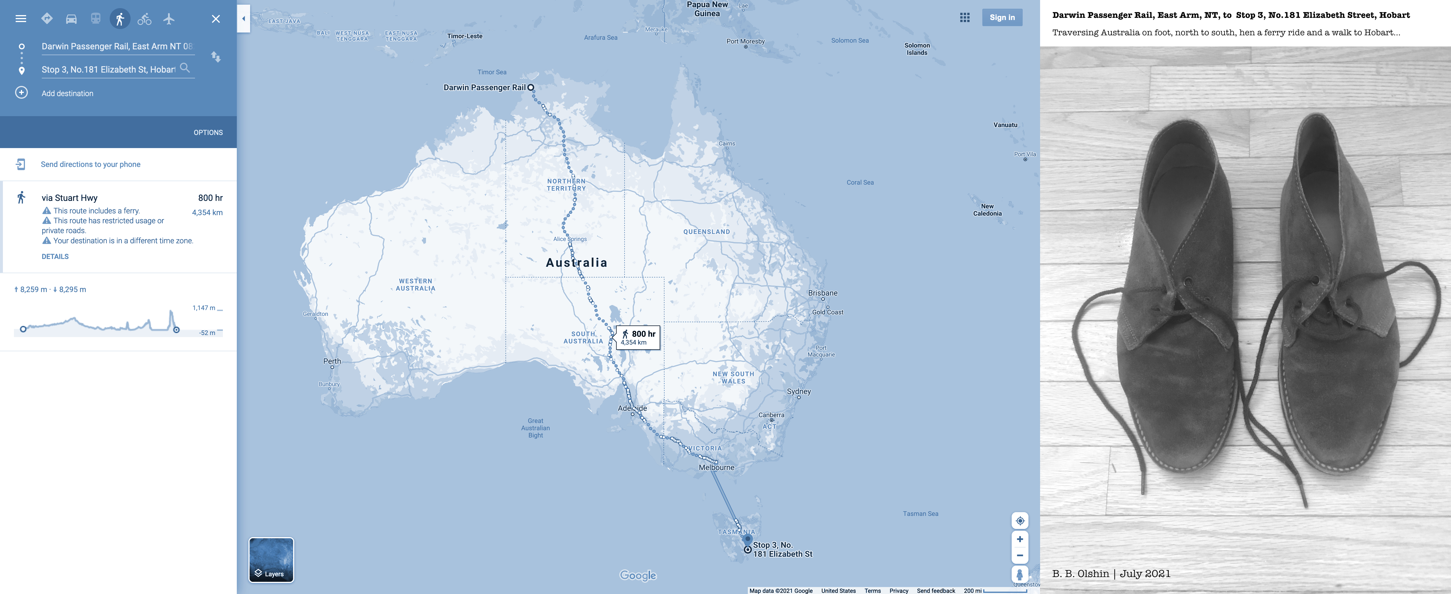
Digital Migration No.4-Darwin Passenger Rail DRW to Stop 3, No.181 Elizabeth Street HBA
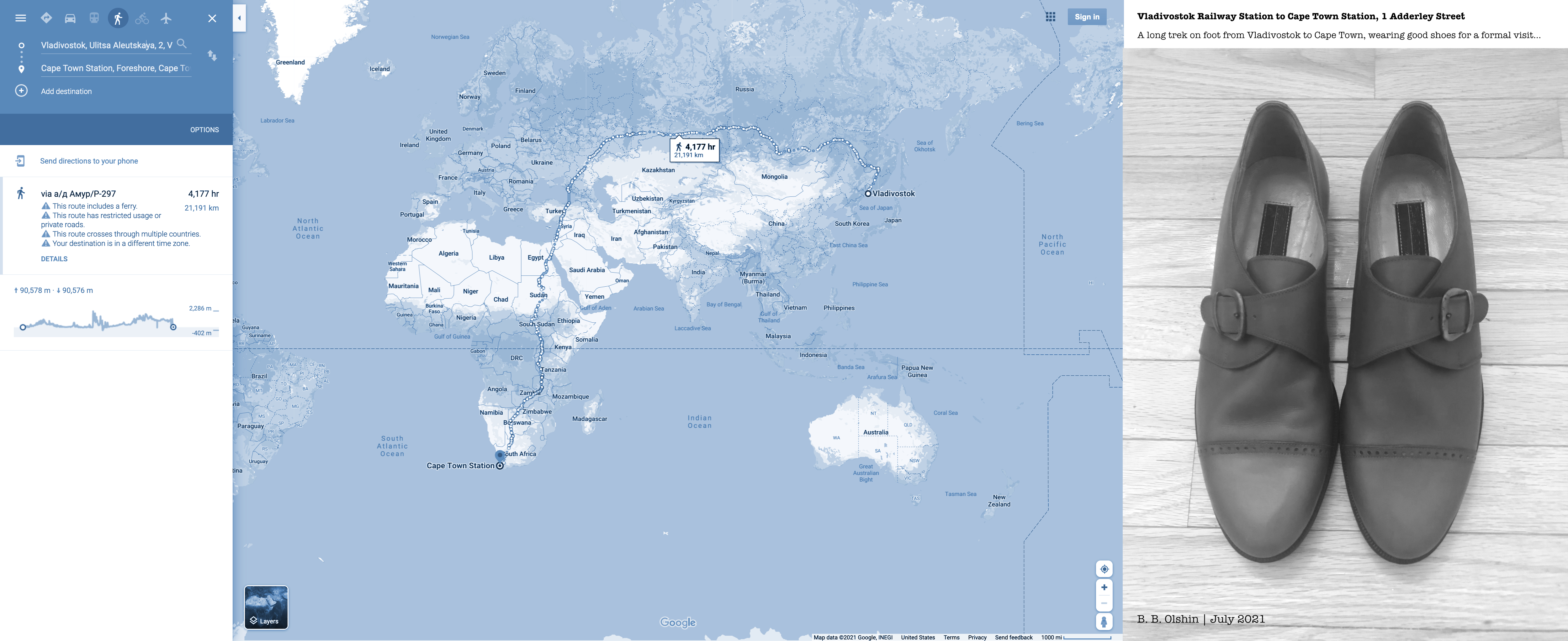
Digital Migration No.8-Vladivostok Railway Station, Ulitsa Aleutskaya, 2 VVO to Cape Town Station, 1 Adderley Street CPT